A dark silhouette of a city skyline set against a cloudy sky. Tall buildings with distinctive shapes are visible, including skyscrapers and what appears to be a tower. The skyline creates a stark contrast with the lighter sky above.
A map of Nigeria shows diarrhea-related child mortality rates per 1,000 children. The highest rate is in Yobe State (9.5 deaths), marked in dark purple, and the lowest rate is in Bayelsa State (1.6 deaths), marked in light yellow. Text highlights a six-fold variation in 2015.
Apr 09, 2019

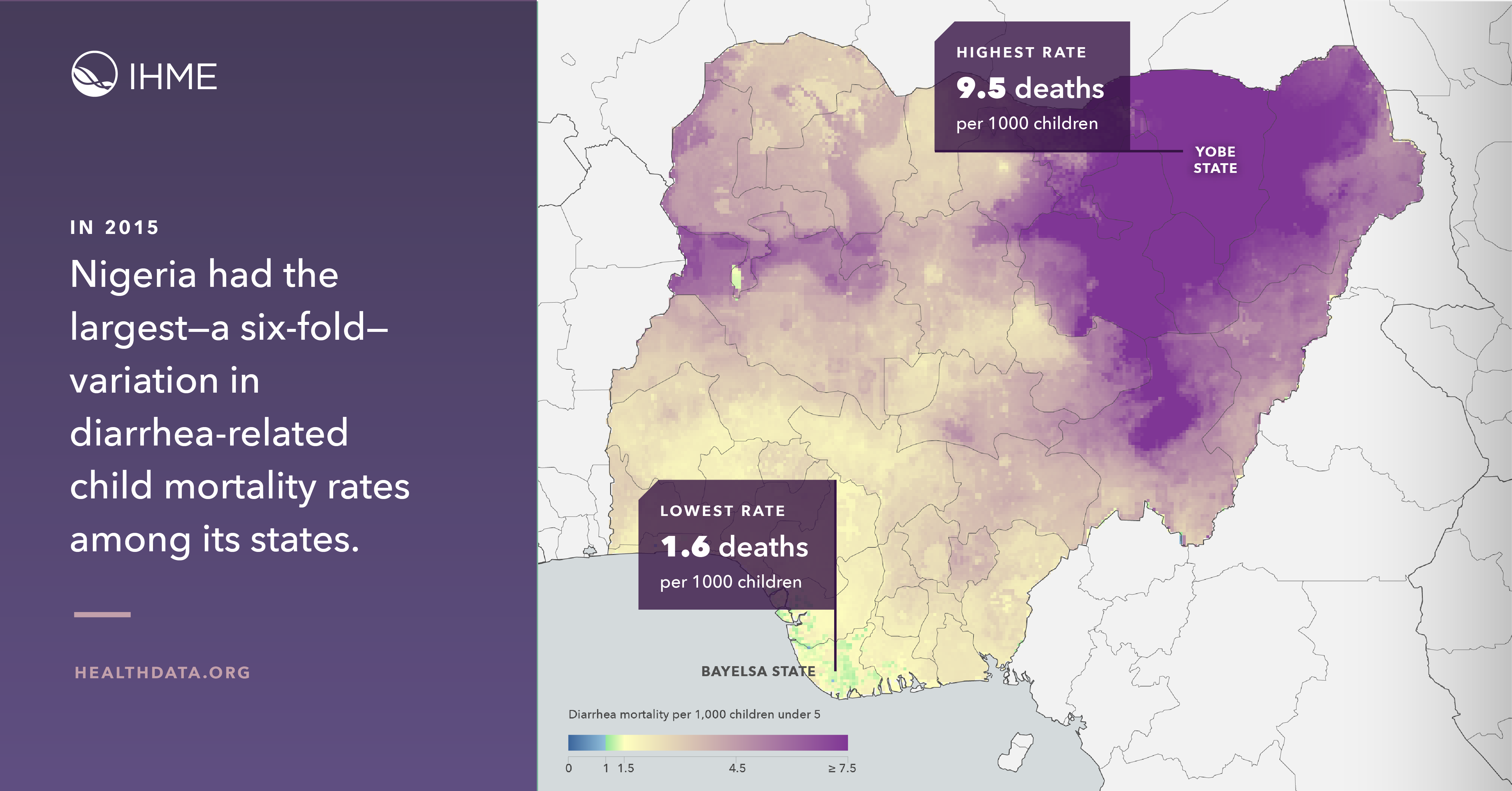
Precision mapping can help save lives from diarrhea

Knowing localized areas of highest risk can enable more focused efforts to defeat diarrheal disease.